Carol Mendel's
Washington D.C. metro area map
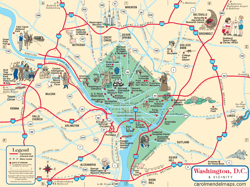
Washington DC and its surrounding area
An enlarged section is shown below.
The illustrated, pictorial map you see here is part of Carol Mendel's Washington D.C. Visitor's Map, a printed map 24" wide by 18" high.
 This map is one of two maps in the Washington DC Visitor Map. The other map is a 24" x 18" map of central Washington DC that covers one entire side of the printed map. The printed visitor map also includes an index for both maps, and visitor information.
Unfortuately, this map is now out of print.
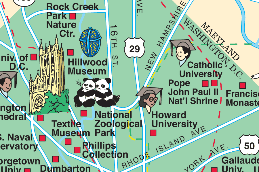
This enlarged section of the map shows an area in the northern part of the city.
Copyright © by Carol Mendel