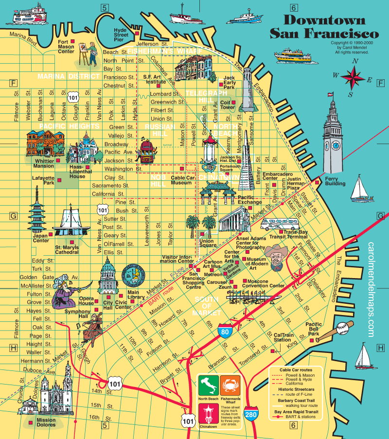
Downtown San Francisco map
The city of San Francisco lies at the northern tip of the San Francisco peninsula, with the Pacific Ocean to the west and San Francisco Bay to the east. The city's most famous landmark is the Golden Gate Bridge, which spans the water where the ocean meets the bay.
Bear in mind that the map downtown San Francisco shown here reflects the year 2000. Some things have changed in the years since. For example, this map does not show the Asian Art Museum, which moved from Golden Gate Park to downtown in 2003.
The products shown below (except for the folded paper map) use versions of this map that have been modified to reflect this change, as well as to incorporate other updates and improvements.
Products based on updated versions of this map
These products are based on updated versions of this map. The wooden trays are based on a 2016 revision, and the other products are based on a 2023 revision.Pillows
A throw pillow brightens a room and provides comfort.
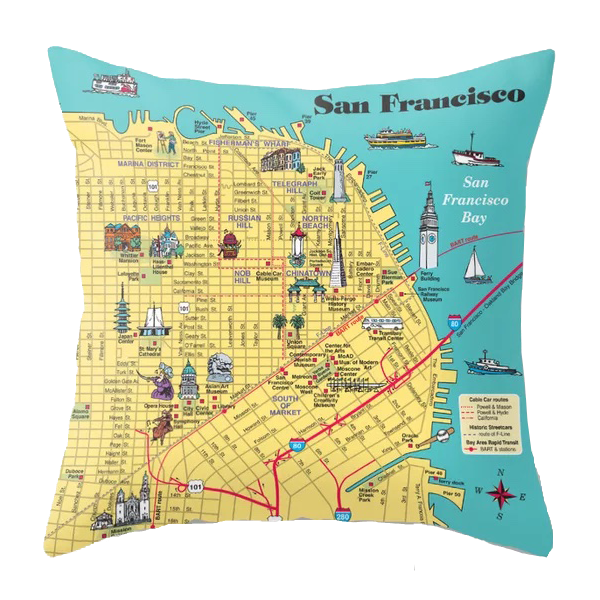 Ordering through Society6.com allows you to choose the size of the pillow. To capture the fine detail on the map, I recommend the 18" or larger size.
Tote Bags
Carry your things in style!
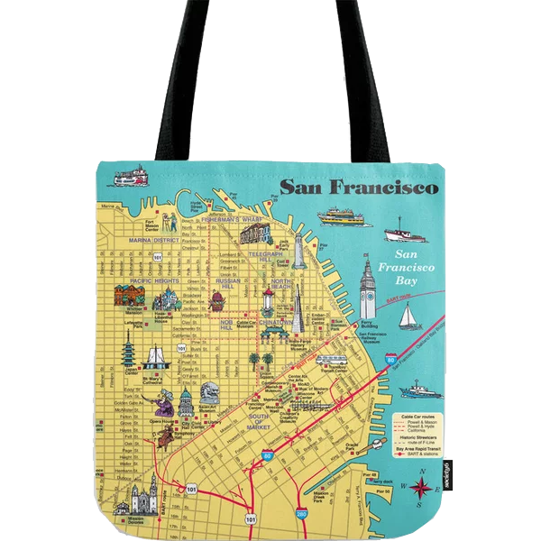
Ordering through Society6.com allows you to choose the size of the pillow. To capture the fine detail on the map, I recommend the 18" or larger size.
Wooden Serving Trays
An illustrated map can evoke a memory, inspire a trip, or bring on a smile.
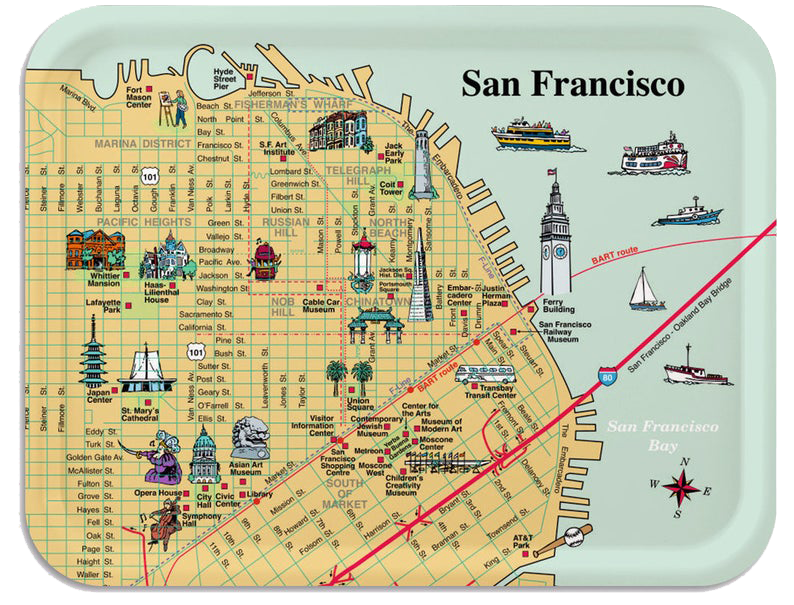
This 11" x 8" tray shows downtown San Francisco.
These trays from Trays4Us are handcrafted in Scandinavia of a birchwood veneer sourced from Certified Sustainable Forests, and then sealed with a matte melamine final layer to protect the wood.
A folded paper map that includes this map
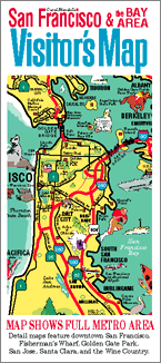
The San Francisco & the Bay Area Visitor’s Map is a full-color, pictorial map of the San Francisco Bay Area. It includes six maps.
One side of the map features an 18" x 24" map of the entire San Francisco Bay Area.
The other side includes five smaller maps, including the year 2000 version of the Downtown San Francisco map shown at the top of this page. The other four maps show Fisherman's Wharf, Golden Gate Park, San Jose & Santa Clara, and the Wine Country.
Copies of the year 2000 edition of this map are still available. For details, click or tap on the image of the folded map.