Carol Mendel's
San Jose & Santa Clara map
|
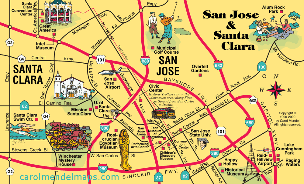
At the south end of San Francisco Bay, San Jose and Santa Clara are in the heart of "Silicon Valley," the high-tech capital of the nation.
Here's a list of the attractions shown on this map: |
|
|
|
This map of San Jose & Santa Clara was part of Carol Mendel's San Francisco Bay Area Visitor's Map, a printed map 24" wide by 18" high.
Covering one entire side of the printed map was a pictorial map showing all of the San Francisco Bay Area, featuring main roads and visitor attractions.
The San Jose & Santa Clara map measured approximately 8" wide by 5" high, and was one of five smaller maps included on the other side. The other maps focused on Downtown San Francisco, Golden Gate Park, Fisherman's Wharf, and the Wine Country. An index covered all the maps.