Carol Mendel's
Golden Gate Park map
|
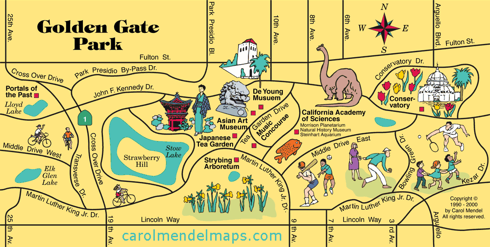
Covering over 1000 acres, Golden Gate Park offers museums, sports facilities, foot trails, bridle paths, lakes, gardens, and an outdoor music concourse. This map shows the eastern half of the park, the area most popular with visitors.
Here's a list of the attractions shown on this map: |
|
|
|
| * The map shown here is from the San Francisco & the Bay Area Vistior's Map, a printed map. The Asian Art Museum moved to a downtown location after that map was printed. | |
This map of Golden Gate Park was part of Carol Mendel's San Francisco Bay Area Visitor's Map, a printed map 24" wide by 18" high.
Covering one entire side of the printed map was a pictorial map showing all of the San Francisco Bay Area, featuring main roads and visitor attractions.
The Golden Gate Park map measured approximately 8" wide by 4" high, and was one of five smaller maps included on the other side. The other maps focused on Downtown San Francisco, San Jose & Santa Clara, Fisherman's Wharf, and the Wine Country. An index covered all the maps.
Copyright © by Carol Mendel