Carol Mendel's
Salt Lake City & the Wasatch Front Visitor's Map
A paper map that includes three maps of the Salt Lake City area
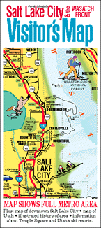 This is a full-color, pictorial map of the Salt Lake City area. The large type makes it easy to read, and the many illustrations make it fun to use.
On one side is an illustrated map of Salt Lake City and the surrounding area.
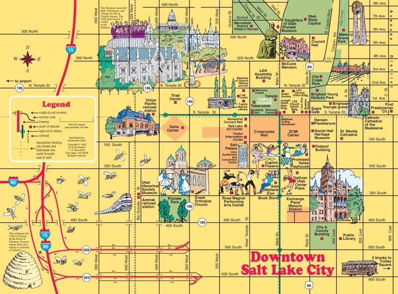
The other side includes illustrated maps of downtown Salt Lake City and the state of Utah, along with an index and information about ski resorts.
The map measures 18” x 24”, folded to 4” x 9”. It was published in 2000.
In addition to being available as a folded map, the central section of the Salt Lake City area map is available on a wooden serving tray. See below.
The folded paper map costs $5, including shipping, handling, and any sales taxes, as long as it is mailed to a U.S address.
To order a copy of this map, and have it mailed to a U.S. address, click on the "Add to Cart" button below. It takes you to PayPal, a secure site, where you can pay with a credit card, a debit card, or a PayPal account.
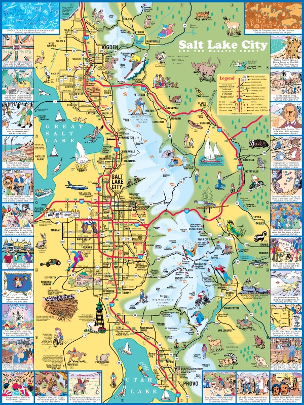
The 18" x 24" map of the Salt Lake City area.
For an enlarged version of this map, plus additional information, go here.
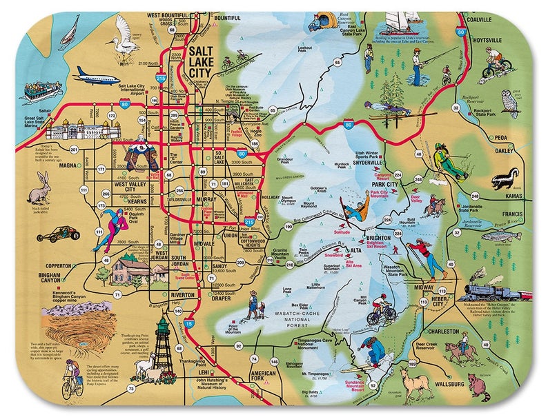
The wooden tray based on this map, available from Trays4Us. [DETAILS]
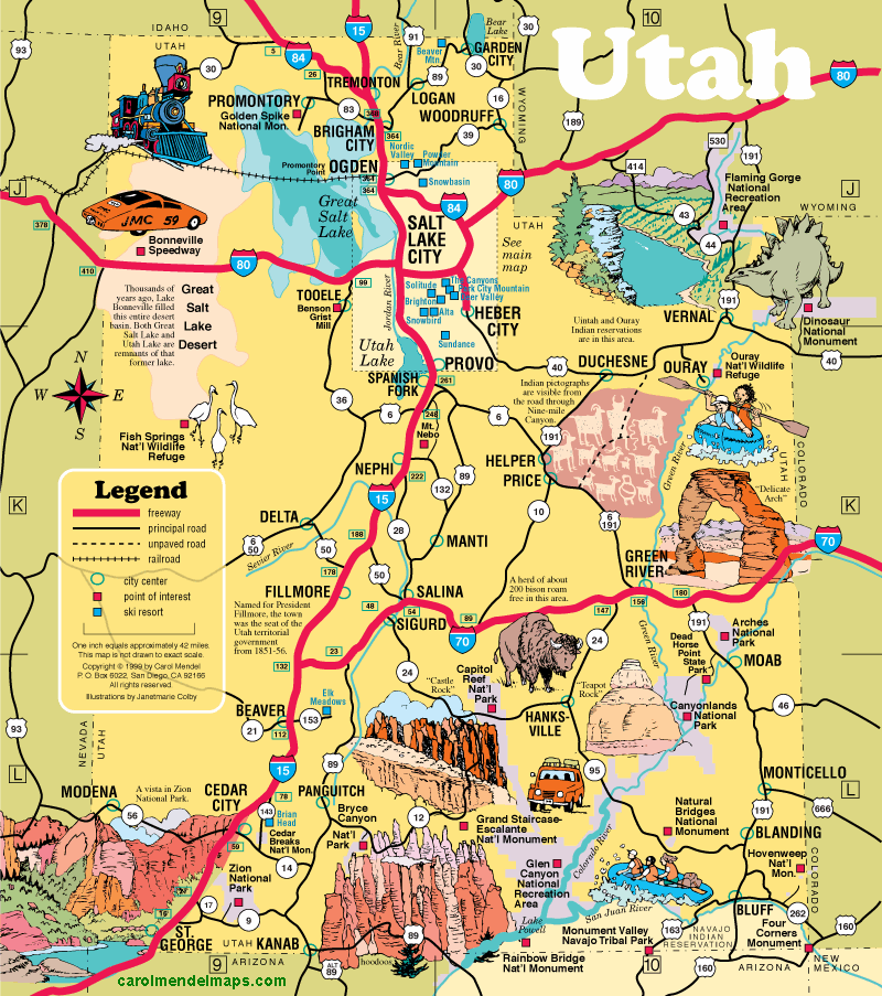
This 8" x 9" map of Utah map is included in the Visitor's Map.
Copyright © by Carol Mendel