Carol Mendel's
Salt Lake City metropolitan area map
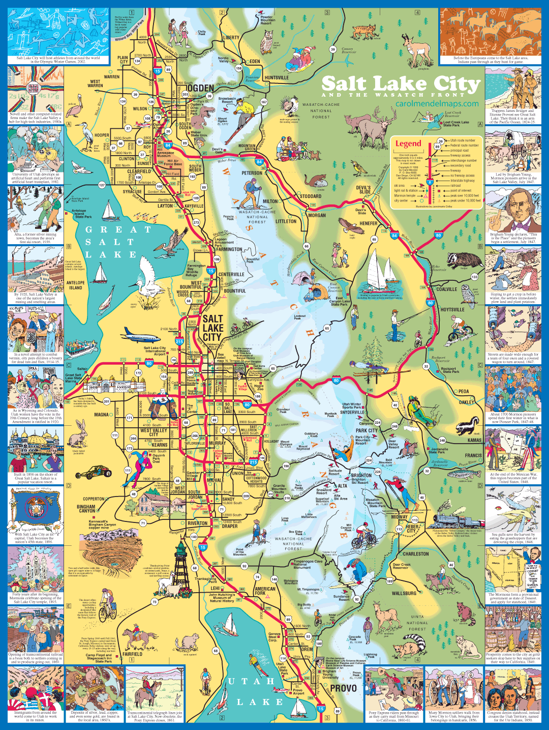
The map features the area from Ogden in the north to Provo in the south, and from Great Salt Lake on the west to the Wasatch Front on the east. Dozens of illustrations highlight the points of interest. Surrounding the map is a border illustrating important events in the area's history.
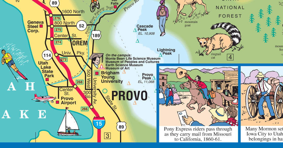
This enlarged section of the map shows the clarity provided on the printed maps.
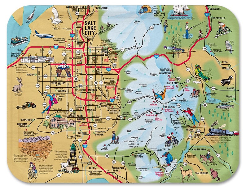
This wooden serving tray covers the central area of the map. It can be purchased on Amazon or Etsy. [DETAILS]
Copyright © by Carol Mendel