Carol Mendel's
Downtown Portland map

pictorial, illustrated map of downtown Portland

The city of Portland is the largest city in Oregon, although not the capital. (The capital is Salem.) It is located where the Columbia River, flowing west, meets up with the Willamette River, flowing north.

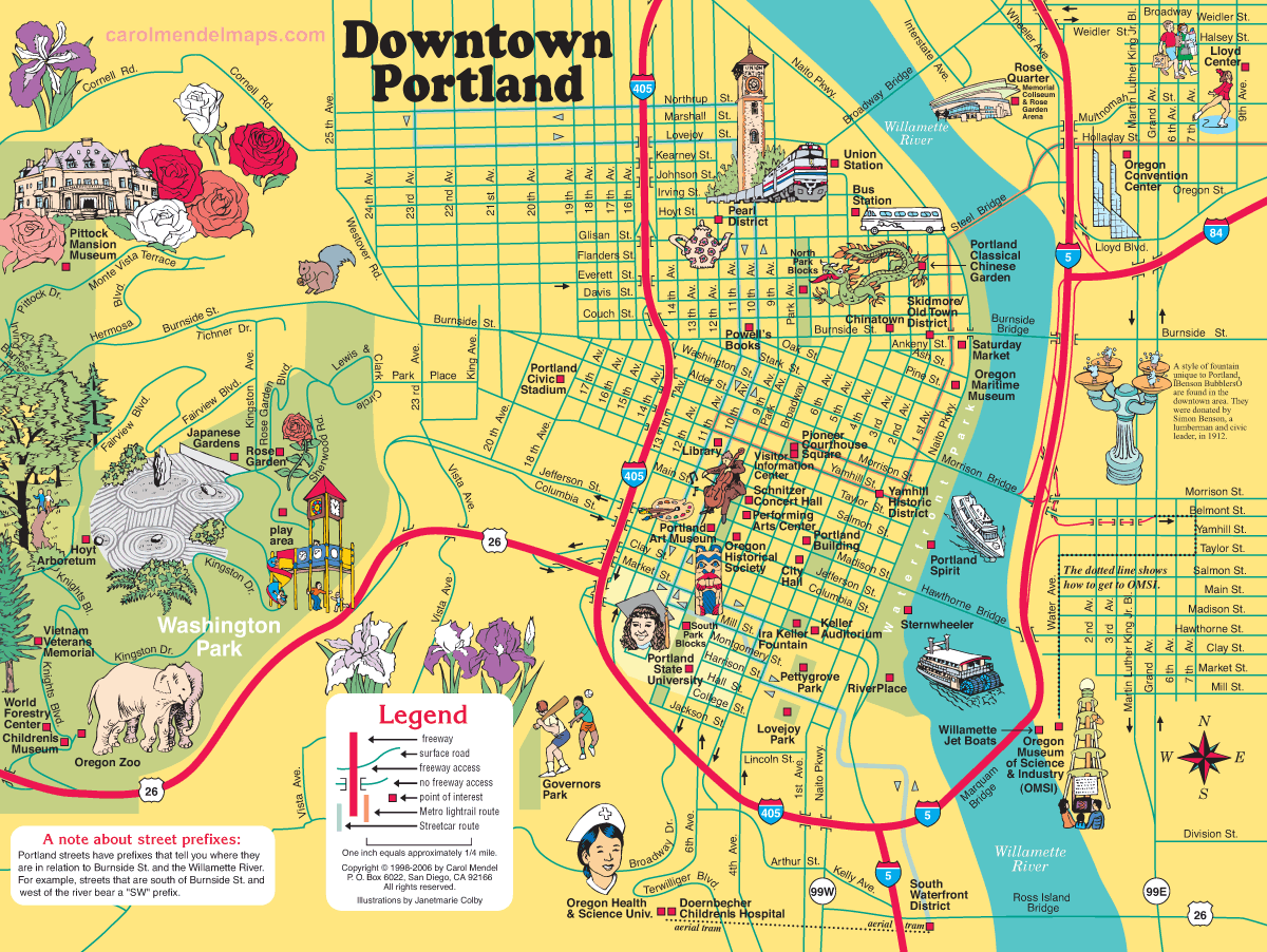
Downtwon Portland is on the west side of the Willamette River.

This map of downtown Portland shows the location of many of the city's important attractions. Bear in mind that this map reflects the year 2006. A few things may have changed in the years since. Here's the list:
  • Children's Museum
  • Chinatown
  • Doernbecher Children's Hospital
  • Hoyt Arboretum
  • Ira Keller Fountain
  • Lovejoy Park
  • Oregon Health & Science University
  • Oregon Historical Society
  • Oregon Maritime Museum
  • Oregon Zoo
  • Pearl District
  • Pioneer Courthouse Square
  • Pittock Mansion Museum
  • Portland Art Museum
  • Portland Building
  • Portland Center for the Performing Arts
  • Portland Civic Stadium
  • Portland State University
  • Powell's Books
  • Rose Garden
  • Rose Quarter
  • Saturday Market
  • Schnitzer Concert Hall
  • Union Station
  • Washington Park
  • Yamhill Historic District


More maps about Oregon:

This illustrared map of downtown Portland was originally part of Carol Mendel's Oregon Visitor's Map, a printed paper map containing three illustrated maps. For information about the other maps, go HERE.


A wooden tray based on this map:

Portland map tray


A version of the downtown Portland map is available on Etsy as an 11" x 8" laminated wooden serving tray. For details, click here.


Downtown maps of other cities
The illustrated maps on this website include many downtown maps. Here's the full list:
Los Angeles

Pasadena

Portland

Sacramento

Salt Lake City
San Diego

San Francisco

Santa Barbara

Solvang

Washington DC


Home Privacy Contact About Sitemap

Copyright © by Carol Mendel