Walking Tours
Home Page
Sunset Cliffs
a walking tour by Carol Mendel
|
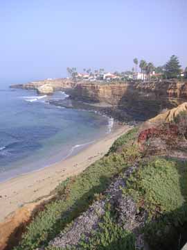
Today a series of heavily eroded, and still eroding, cliffs establishes the border where the western shore of Point Loma meets the Pacific Ocean. This area is known as Sunset Cliffs.
This self-guided walking tour follows the ocean-front road along wave-carved cliffs to the community of Ocean Beach. When you reach Ocean Beach, the route leaves the shore and follows a residential route.
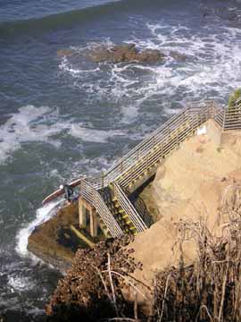
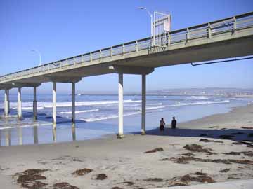
You complete your walk 2000 feet out over the Pacific Ocean, at the end of the longest fishing pier on the West Coast.
Distance: Two and a half miles. Time: An hour and a half, one way. Note: This walk does not bring you back to your starting point.
MAP of the walking tour
Terms of Use
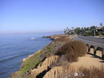
Begin your walking tour along Sunset Cliffs 60 feet above the Pacific surf, at the intersection of Sunset Cliffs Boulevard and Ladera Street.
|
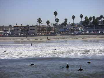
Offshore, you'll probably be able to make out some kelp beds. Look for areas of water with an orange cast. Closer to shore, the waves make this a popular area for surfers.
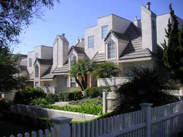
Next look up at the homes on the Point Loma hillside -- the hillside is steep enough that the homes have a good view of the Pacific.
|
The deeply sculpted Sunset Cliffs pay tribute to the immense power of erosion. Again and again you pass areas where erosion has encroached on the land enough that keeping a path where pedestrians can walk has required narrowing Sunset Cliffs Boulevard. The City of San Diego has attempted to slow the erosion by placing rocks at the base of the cliffs, but the forces of erosion are winning the battle.
|
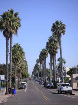
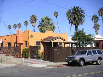
At Adair Street, Sunset Cliffs Boulevard leaves the shore's edge, and you enter Ocean Beach, a community of pastel-colored homes.
|
|
Turn right at Bacon Street.
From Bacon Street, turn left at Niagara Avenue. On your right, on the side of a building formerly home to an electronics company, you'll find a "History of Electricity" mural.
Continue along Niagara, out to the Ocean Beach Pier.
|
|
One block north of the pier is Newport Avenue, the main commercial area of Ocean Beach.
Return to top.
|
Enjoy this walking tour?
Check out the others in this series Balboa Park Cabrillo National Monument Downtown San Diego The Embarcadero La Jolla La Playa Mission Bay Park Mission Beach Old Town Shelter Island Sunset Cliffs |
Enjoy full-color illustrated maps? Check out the ones below. Some can be purchased as laminated maps, some as folded maps, some as wooden trays, and some as all three. San Diego Los Angeles Palm Springs Santa Barbara San Francisco Bay Area Las Vegas Salt Lake City Oregon Washington DC |